Truck Route Optimisation Software in NZ: What Delivery Fleets Should Look For
Drafted with AI assistance, edited and fact-checked by Sean Flannery. See our editorial policy.
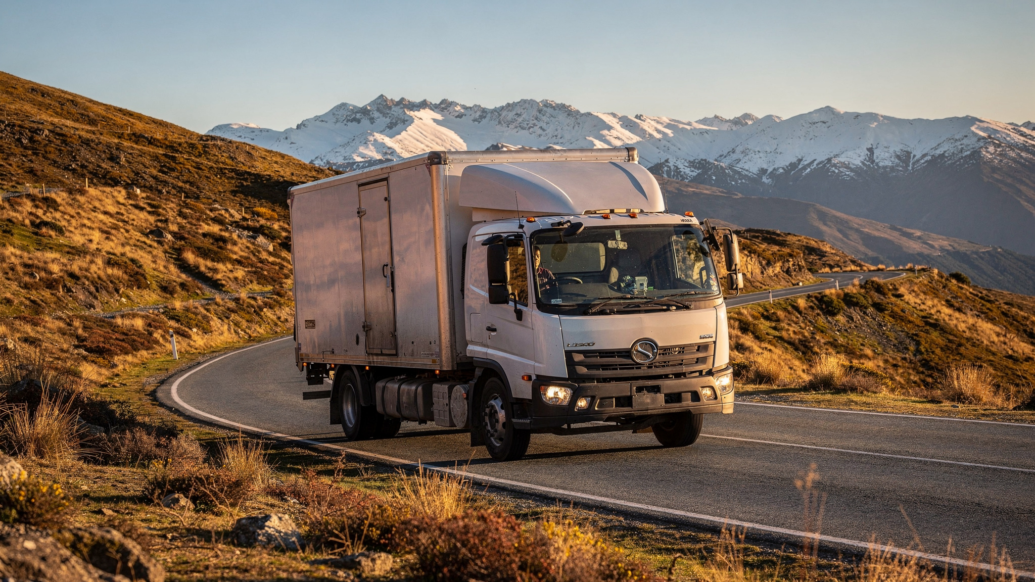
Truck route optimisation software sequences stops for rigid trucks and truck-and-trailer units using vehicle profiles, delivery windows and live road conditions, then re-plans when a highway closes. For New Zealand fleets, where road carries 93 per cent of freight by weight according to the Ministry of Transport's National Freight Demand Study (2017/18 data, published October 2019), dependable arrival times matter as much as the shortest kilometres.
Picture a Monday at a Hamilton depot. A four-axle rigid is loaded for Waikato farm supply stops, another truck heads north to reach Auckland before the morning peak, and a linehaul unit is booked onto a Cook Strait sailing.
Each run succeeds on a different measure: stop order for the farm run, timing for the Auckland leg, a fixed check-in for the ferry. Good routing software plans all of them together.
What truck route optimisation software does for a New Zealand delivery fleet
Give the software a day's orders and it works out which truck takes which stops, in what order, and roughly when each one will arrive.
For a truck fleet, the inputs go well beyond addresses. A useful plan draws on:
- Vehicle profiles: body type, capacity and any size limits that decide which roads and sites a truck can reach
- Delivery windows and receiving hours at each site
- Service time at each stop, from a quick pallet drop to a crane unload
- Driver start times and availability
- Live road conditions, closures and planned works
Where a truck's dimensions or mass affect which roads it can use, check the current requirements with NZ Transport Agency Waka Kotahi and record them in the vehicle profile, so every plan starts from the right assumptions.
The output is a sequenced run for each vehicle, an estimated arrival for every stop, and a plan that can be re-optimised when something changes mid-day.
Where does this pay off most? Multi-drop general freight. In the same Ministry of Transport freight study, manufactured goods, retail goods and general freight formed the largest commodity group: 96.7 million tonnes, or 35% of all freight moved in 2017/18.
That is the freight that leaves a depot on a rigid truck and gets dropped at many addresses. The more stops a run carries, the more a planner gains from letting software handle the sequencing.
For the mechanics behind it, Locate2u's guide to how route optimisation works and why it matters walks through the process step by step.
How one pharmacy delivery team cut daily route planning from an hour to 10 minutes
SuperPharmacy is not a truck fleet. It is an Australian online pharmacy, operating since 2000, that delivers prescriptions, over-the-counter products and health essentials to customers nationwide.
But its planning challenge will feel familiar to any New Zealand dispatcher running multi-drop routes.
On its case study page, SuperPharmacy explains that its delivery team was spending up to one hour every day manually planning routes for prescription deliveries.
Flexibility was the bigger constraint. If an urgent prescription arrived during the day, or a delivery needed rescheduling, the whole route had to be regenerated from scratch. With customers increasingly expecting same-day delivery, the team needed planning that could keep pace.
After moving to Locate2u's route optimisation, the planning that once took an hour takes 10 minutes, cutting route planning time by 83%, according to the case study. Routes are generated automatically from delivery locations, time windows and driver availability.
New prescriptions can be slotted into existing routes during the day without disrupting other deliveries. That flexibility let SuperPharmacy offer same-day prescription delivery as a core service.
As the team says on its case study page: "Before Locate2u, we had to generate new routes if we wanted to change anything. Now we can adjust the day's deliveries on the fly."
Now translate that to a Christchurch building supplies depot. A builder calls mid-morning for extra plasterboard on a Rolleston site. Slotting that stop into a live route, instead of rebuilding the day, keeps the afternoon on schedule.
Results depend on order volume and fleet mix. The full SuperPharmacy route planning story shows what faster, more flexible planning made possible for its team.
Why dependable travel times help you promise delivery windows customers can plan around
Customers rarely ask for the shortest route. They ask when the truck will turn up.
A builder booking a crane. A retailer rostering staff to unload. A farm manager leaving the gate open. Each of them plans the day around your estimated arrival.
Reliable travel times are harder to find than distances. The Ministry of Transport's October 2025 Transport Network Performance Report notes that it does not currently have appropriate and frequent measures of road reliability.
So the most useful reliability data a fleet holds is its own. With live tracking in place, each completed run records when trucks actually arrived and how long they spent at every stop.
Feed that history back into planning and windows start to reflect how your corridors really behave early in the morning compared with mid-afternoon.
This turns route choice into a question of dependability. A slightly longer route with steady travel times can support a tighter, more accurate window than a shorter route through a corridor that swings between free-flowing and slow.
Once the window is set, share it. Real-time tracking shows dispatchers every truck on a live map and gives customers a tracking link, so updated arrival times reach them without a phone call.
On the road, the Locate2u driver app gives drivers their sequenced run and captures timestamped proof of delivery at each stop, building the history that sharpens the next plan.
How to plan Auckland runs around the 8am peak and busy freight corridors
Auckland's morning traffic reaches its highest levels at about 8am, when driving 10km takes an average of 19 minutes, according to RNZ reporting carried by the NZ Herald in March 2025.
The same report said Auckland's congestion was projected to cost NZ$2.6 billion a year by 2026, with NZ$1.9 billion of that from traffic delays. Each truck-hour planned outside the peak is time spent delivering.
Where sites can receive early, dispatch earlier so the first drops are done before the peak builds.
Sequence each run so trucks work within a cluster of nearby stops during the peak, instead of crossing the city.
Give peak-hour stops wider windows, then tighten them for mid-morning drops once traffic eases.
Runs that start or finish near the inland port at Wiri or the port at Onehunga share those corridors with plenty of heavy traffic, so timing them around both peaks pays off.
To test a platform here, plan a real Auckland morning, then compare the promised times with the tracked arrivals.
Using per-kilometre truck costs to compare route options: a worked example
Distance still costs money, and the Ministry of Transport's Domestic Transport Costs and Charges Study, Working Paper C5, published in June 2023, gives New Zealand fleets a useful reference point.
It put total truck operating costs, including driver costs, at 375 NZ cents per km for a two-axle rigid and 588 NZ cents per km for a four-axle rigid. These are 2018/19 values, excluding GST.
Costs have moved a long way since then, especially after this year's diesel price swings. Use the method below, then swap in your own current cost per km.
Take a worked example. A planner has two options for the same run. Route A is 80 km through a corridor that slows at the morning peak. Route B is 92 km on roads with steadier travel times.
Worked example: operating cost by route option, 2018/19 values excluding GST
| Route option | Distance | Two-axle rigid at 375 NZ cents per km | Four-axle rigid at 588 NZ cents per km |
|---|---|---|---|
| Route A: shorter, peak corridor | 80 km | NZ$300 | NZ$470.40 |
| Route B: longer, steadier travel times | 92 km | NZ$345 | NZ$540.96 |
| Difference | 12 km | NZ$45 | NZ$70.56 |
So the steadier route costs NZ$45 more on the two-axle rigid and NZ$70.56 more on the four-axle rigid.
Now weigh that against time. The same paper puts truck driver time costs typically at NZ$24 to NZ$36 per hour. Because the per-km totals already include driver costs, use the hourly range only for extra time beyond the drive itself, such as waiting at a site.
Suppose Route A runs late and the truck waits 30 minutes for the next unloading slot. At NZ$24 to NZ$36 per hour, that wait adds driver time.
On those numbers alone, Route A still comes out cheaper. The decision turns on what a late arrival does to the rest of the day. A missed crane booking, or a string of later stops pushed back, can make Route B the better choice.
Putting a cost next to each option keeps that trade-off in plain view. The software does the arithmetic, and the planner makes the call.
How route planning software helps fleets adjust when alpine passes close for snow
South Island winters bring snow to the alpine passes, and fleets serving the West Coast, Nelson or the Mackenzie Basin plan around it each winter.
A NZ Transport Agency Waka Kotahi traffic bulletin on 3 July 2026 forecast up to 20cm of snow in the Porters Pass area on SH73 and the Lewis Pass area on SH7, with a risk of 10-plus cm in the Burkes Pass to Lake Tekapo area the following day.
Snow on that scale could mean closures or restrictions on those highways. The same bulletin asked high-sided vehicles to take particular care in severe gales, useful context for anyone routing curtain-siders or box bodies through the Canterbury high country.
Routing software helps in a few practical ways when a pass is forecast to close.
Re-plan before the trucks leave. When a bulletin lands the evening before, planners can move affected stops to another day or route and re-optimise the rest, so the remaining runs stay efficient.
Keep alternatives ready. Note the usual alternative for each regular alpine run, so a planner can re-sequence quickly instead of starting from a blank page.
Tell customers early. A revised arrival sent through a tracking link lets a Greymouth or Westport customer plan around a later delivery.
Locate2u's dispatch planning tools give planners a live view of every vehicle, so a truck held at Springfield or Culverden can be re-sequenced or its next jobs reassigned as soon as conditions change.
Winter is also a good time to widen service times on alpine runs, so estimated arrivals stay realistic in slower conditions.
Linking state highway legs with local delivery stops on the same plan
A freight job that crosses regions usually has a state highway leg in the middle and local stops at each end.
Those highways are busy. The Ministry of Transport's network performance report counted around 566 thousand heavy vehicles per month on state highways between July 2024 and June 2025.
With that much heavy traffic on the network, the linehaul leg deserves the same planning attention as the local stops. Its arrival time sets the start of every delivery that follows.
The freight figures point the same way. In the Ministry of Transport's 2017/18 freight demand study, road carried 93 per cent of freight by tonnes but 75 per cent by tonne-km, reflecting the longer average distances goods travel by rail or coastal shipping.
In other words, road does much of the shorter-distance work, where stop sequence and delivery windows shape the day.
Joining the two starts with treating hand-over points as fixed appointments. For a terminal slot or a Cook Strait ferry check-in, set a time window on that stop so the linehaul leg arrives with margin.
Then plan the local runs on the far side as separate routes starting from the arrival terminal or cross-dock. A Palmerston North depot can send a truck-and-trailer unit to Wellington for a booked sailing, while Blenheim and Nelson runs start from Picton.
With both legs on one plan, a late linehaul arrival shows up early, and local runs can be re-sequenced before they set off.
A practical checklist for testing truck routing software on your own runs
Sample data in a demonstration is always tidy. A fair test puts truck route optimisation software through a week of your own orders, with their real windows and site details.
Use this checklist to run that test.
| What to check | How to test it on your runs |
|---|---|
| Vehicle profiles | Set up each truck type you run, from a two-axle rigid to a truck and trailer, and confirm stops are assigned to vehicles that suit them. |
| Windows and service times | Load real receiving hours and unload times, including crane or forklift drops, and check each stop lands inside its window. |
| Fixed appointments | Add a ferry check-in or terminal slot as a timed stop and confirm the linehaul leg is planned to meet it. |
| Mid-day changes | Insert an urgent order into a live run and see whether it slots in without rebuilding the day. |
| Disruption re-planning | Mark a pass or highway as closed and time how long a planner takes to produce a workable alternative. |
| Customer updates | Send a tracking link to a colleague acting as the customer and check the arrival time updates as the truck moves. |
| Planned versus actual | After the week, compare planned and actual arrival and service times by site to see which windows need adjusting. |
| Planning time | Record how long daily planning takes before and during the test, the same measure SuperPharmacy reports. |
Then weigh the cost. The Locate2u pricing page lists current plans, which you can set against the planning time and kilometres your test week recorded.
Involve a driver or two in the trial as well. Their site knowledge about access points and unloading spots, recorded against each address, makes every plan more accurate.
Frequently asked questions
What is linehaul in trucking?
Linehaul generally means moving freight over long distances between terminals or distant cities, typically by truck, as opposed to the local pickup and delivery runs at each end. Routing software usually plans the two differently: linehaul legs are judged on timing and road conditions, local runs on stop sequence and delivery windows.
How can a fleet plan truck routes that include a Cook Strait ferry crossing?
Treat the sailing as a fixed appointment: look for a platform that accepts a time window on a stop, so the linehaul leg reaches the terminal before check-in. Then plan each island's local runs as separate routes that start from the arrival terminal.
Does route optimisation software replace a driver's local knowledge?
No. The software handles the arithmetic of sequencing many stops and re-planning when conditions change, while drivers bring site knowledge such as access points, unloading spots and customer preferences, and the best results come from recording those site notes against each address so every driver and planner can see them.
What data should a fleet record to make route plans more accurate over time?
Record planned versus actual arrival times and the time spent at each stop, broken down by customer site and time of day. After a few weeks this history shows which stops need longer service times and which corridors run slow at certain hours, so future plans set more realistic windows.
The practical takeaway: choose routes your customers can plan around, price the trade-offs with real per-kilometre costs, and let your own delivery history set the windows. When you are ready to try that on your fleet, start with Locate2u's route optimisation software and plan a week of your real orders in it.